
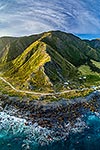
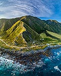
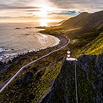
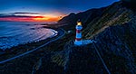
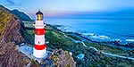
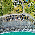
. Aerial panorama at dusk with Aoraki Ranges (Haurangi Forest Park) beyond, Cape Palliser, South Wairarapa District, Wellington Region, New Zealand (NZ) stock photo.")
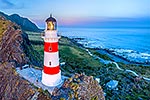
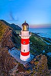
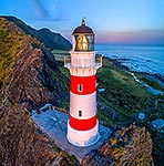
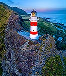
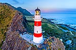
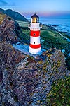
Cape Palliser lighthouse on the southern most point of the North Island (Matakitakiakupe). Aerial panorama at dusk with Aoraki Ranges (Haurangi Forest Park) beyond, Cape Palliser, South Wairarapa District, Wellington Region, New Zealand (NZ), stock photo.
 EMAIL TO FRIEND
- Location:
- Cape Palliser (other locations)
- District:
- South Wairarapa (see districts)
- Region:
- Wellington (see regions)
- Country:
- New Zealand (NZ)
- Notes:
- Large file (10940 x 3949 pixels native, no interpolation. | Ratio (height:width) 1:2.77
- Photographer:
- Rob Suisted
- Image #:
- 56483TN00
Keywords (advanced)
Related images
Similar images
Random images

. Aerial panorama at dusk with Aoraki Ranges (Haurangi Forest Park) beyond, Cape Palliser, South Wairarapa District, Wellington Region, New Zealand (NZ)")